Lohagad Trek Guide: Vinchu Kata, Four Gateways, Routes & Best Season
If there is one fort that turns people into trekkers, it is Lohagad. The climb is short, the trail is paved most of the way, the train drops you almost at the base, and what waits at the top is a complete hill fort with four intact gateways and a ridge that curls out into the valley like a scorpion’s tail. It is the trek we recommend more than any other to someone who has never done one.
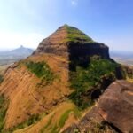
Lohagad sits at about 1,033 m (3,389 ft) in the Maval region of Pune district, just off the Mumbai–Pune corridor near Lonavala. It is one of the twelve forts that make up India’s Maratha Military Landscapes UNESCO World Heritage inscription, and on a clear monsoon morning you can see why it mattered: Pawna lake on one side, the Bhaja and Karla cave hills on the other, and the old trade route through the Bhor Ghat running right below.
Quick Lohagad trek facts
- Height: about 1,033 m (3,389 ft) above sea level
- Base village: Lohagadwadi, Maval taluka, Pune district
- Nearest railway station: Malavli, on the Mumbai–Pune local line
- Grade: Easy — suitable for first-time trekkers, families and children
- Climb time: 45 minutes to 1.5 hours from Lohagadwadi; 2.5 to 3 hours from Malavli station on foot
- Distance: roughly 95 km from Mumbai, 65 km from Pune
- Best season: June to February, with monsoon the most popular
What you will see on the Lohagad trek
1. Vinchu Kata — the scorpion’s tail
A long, narrow spur of rock runs nearly 1.5 km out from the fort into the valley, curving at the end exactly like a scorpion’s raised tail — which is how it got its name. It was a watch post, and standing on it in the monsoon with cloud pouring over both edges is the single best moment of this trek. Walk it carefully: the rock is slick after rain and there is no railing. On very windy or heavily overcast days our trek leads keep the group off the far end.
2. The four gateways
The approach climbs through four successive fortified gates — Ganesh Darwaja, Narayan Darwaja, Hanuman Darwaja and Maha Darwaja. They are staggered deliberately, so an attacking force never got a straight run at the summit. Hanuman Darwaja is the oldest of the four. Much of the stonework you walk through today was strengthened in the late 18th century under Nana Phadnavis.
3. The summit plateau
On top there is a dargah, a small Shiva temple, the remains of living quarters and several large water cisterns cut into the rock. The plateau is broad and flat, which makes Lohagad an easy fort to spend an hour on rather than turn around at once.
4. Visapur, Bhaja and Karla
Lohagad’s twin fort Visapur stands directly opposite and is higher, rougher and far emptier — the two are often combined into one long day. The Bhaja caves, 2nd-century BCE Buddhist rock-cut viharas with a waterfall beside them in the monsoon, are a short walk from Malavli station, and the larger Karla caves are a few kilometres away. If you are travelling all the way from Mumbai, pairing Lohagad with Bhaja makes the day worth the distance.
A short history of Lohagad
Lohagad is old — it passed through the Satavahanas, Chalukyas, Rashtrakutas, Yadavas, the Bahamani sultanate and the Nizam Shahis long before the Marathas. Chhatrapati Shivaji Maharaj took it in 1648, surrendered it under the Treaty of Purandar in 1665, and took it back in 1670. For a period it served as a treasury: part of the wealth from the Surat campaign is said to have been held here, which tells you how secure the fort was considered. In the 18th century it came under Nana Phadnavis, who built several of the structures still standing.
The route, step by step
- Malavli station to Bhaja village — cross the tracks and follow the road for about 2 km. You can also take a rickshaw from the station.
- Bhaja to Lohagadwadi — a further 4 to 5 km of road, motorable all the way. Most groups drive to Lohagadwadi and start walking there; doing it on foot adds about an hour each way.
- Lohagadwadi to the first gate — 20 minutes up a broad stepped path lined with stalls selling lemon water and bhajiya.
- Through the four gateways — another 25 to 35 minutes of steady stepped climbing. Shaded in parts, and the steps are wide.
- Summit plateau and Vinchu Kata — allow 45 minutes to an hour on top to walk out along the tail and back.
Total walking time from Lohagadwadi and back is about 2.5 to 3 hours at an unhurried pace, including time on the summit.
Best season for the Lohagad trek
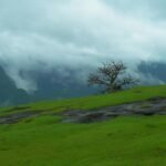
- Monsoon (June to September) — the reason most people come. Waterfalls on the approach, cloud washing over Vinchu Kata, everything green. It is also the most crowded time, especially on weekends, so start early.
- Post-monsoon (October to November) — our pick. Still green, clear views across to Pawna lake and Visapur, far fewer people.
- Winter (December to February) — cool, dry and comfortable, with the best long-distance visibility of the year.
- Summer (March to May) — doable but hot and exposed by mid-morning. Start before 7 am or leave it for another season.
How to reach Lohagad
From Mumbai
Take a Pune-bound local or express to Lonavala, then the Pune local two stops further to Malavli. From Malavli it is a rickshaw or a 6 to 7 km walk to Lohagadwadi. By road it is about 95 km on the Mumbai–Pune Expressway, exiting at Lonavala.
From Pune
Malavli is about 65 km from Pune and is served by the Pune–Lonavala local line, which makes this one of the cheapest treks you can do from the city. By road it is a comfortable 90-minute drive via the old Mumbai–Pune highway or the expressway.
For how Lohagad compares with everything else within range of each city, see our full lists of treks near Mumbai and treks near Pune, both sorted by road distance.
What to carry
- Two litres of water per person — there are stalls, but carry your own
- Shoes with grip; the stone steps are genuinely slippery in the monsoon
- A poncho rather than an umbrella, because of the wind on the ridge
- A cap and sunscreen outside the monsoon — the plateau has no shade
- Cash for the stalls at the base and on the way up
- A bag for your own waste; Lohagad is a protected monument and gets heavy footfall
Safety notes
- Vinchu Kata has no railings and drops away on both sides. Do not walk out onto it in strong wind or heavy rain, and do not attempt the far end at all if visibility is poor.
- Weekend crowds in the monsoon can make the stepped sections slow and slippery. Starting by 7 am solves most of it.
- Mobile network on the summit is patchy on all providers.
- Stick to the stepped path. The shortcuts across the slope cause erosion and are where most slips happen.
Frequently asked questions
Is the Lohagad trek suitable for beginners?
Yes, and it is one of the best first treks in Maharashtra. The path is stepped and broad nearly all the way, the climb from Lohagadwadi takes under an hour and a half, and there is no rock scrambling or exposure on the main route. Children from about seven upwards manage it comfortably.
How long does the Lohagad trek take?
From Lohagadwadi, about 45 minutes to 1.5 hours up and 45 minutes down, plus an hour on top for Vinchu Kata and the plateau. If you walk from Malavli station instead of driving to the base, add roughly an hour each way.
What is Vinchu Kata at Lohagad?
Vinchu Kata, meaning scorpion’s tail, is the long fortified spur of rock that extends about 1.5 km out from the fort and curves at its end. It served as a watch post over the valley and the old Bhor Ghat trade route. It is the most photographed feature of the fort and the most exposed, so it needs care in wind and rain.
Can Lohagad and Visapur be done in one day?
Yes, and it is a popular combination, but treat it as a full day rather than a half one. Visapur is higher and the trail is rougher and less marked than Lohagad’s. Start at first light, do Visapur first while you are fresh, and keep an eye on the weather — the Visapur route gets genuinely slippery in heavy rain.
Is there food and water on the Lohagad trek?
There are stalls at Lohagadwadi and along the stepped climb selling tea, lemon water, bhajiya, poha and maggi, and a few operate on the plateau in season. Carry at least two litres of your own water anyway, especially outside the monsoon, and carry cash.
How do I reach Lohagad by train?
Get to Malavli station on the Mumbai–Pune local line. From Mumbai, take a train to Lonavala and change to a Pune-bound local for two stops; from Pune, take a Lonavala-bound local directly. From Malavli it is a rickshaw ride or a 6 to 7 km walk to the Lohagadwadi base.
Is Lohagad a UNESCO World Heritage Site?
Lohagad is one of the twelve forts included in India’s Maratha Military Landscapes UNESCO World Heritage inscription, alongside forts such as Raigad, Rajgad, Shivneri, Pratapgad and Salher. In practice that means stricter conservation rules on the fort, so carry your waste down and do not mark or climb on the structures.
Trek Lohagad with us
We run guided group treks across the Sahyadris from both Mumbai and Pune, with transport, meals, a trek lead and fort history included. See what is coming up on our upcoming trek plans page, or message us on WhatsApp at +91 8976874681 to ask about a Lohagad batch.