

Dronagiri Fort (Uran): A Forgotten Coastal Hill Fort on the Arabian Sea
Don't just climb a fort live its history! The perfect blend of safety, wholesome regional meals, and guided exploration.
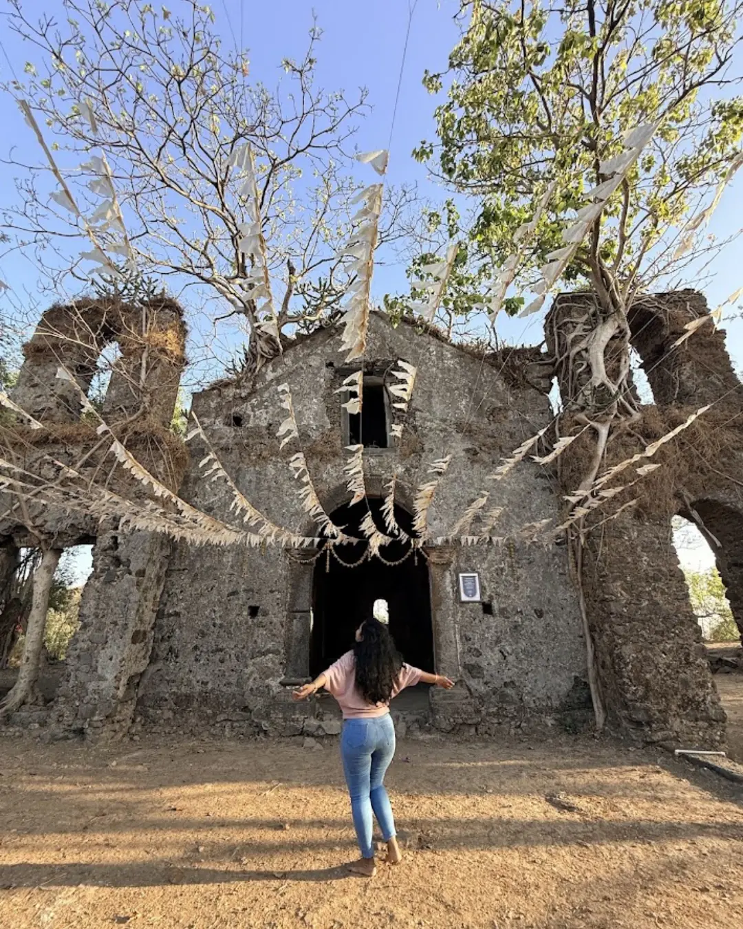
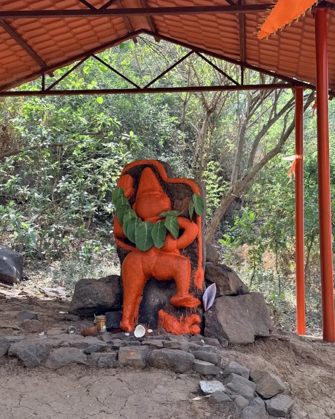
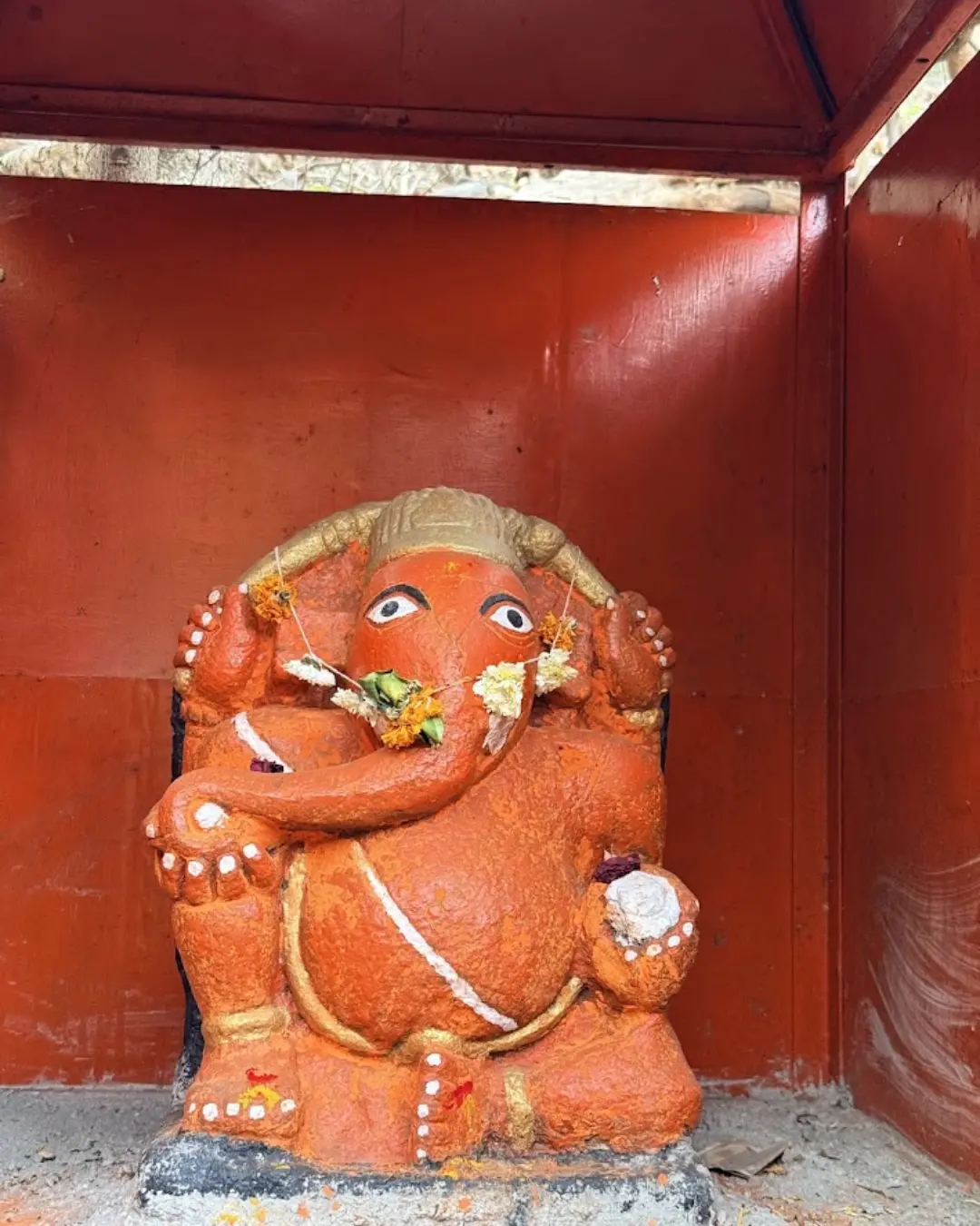
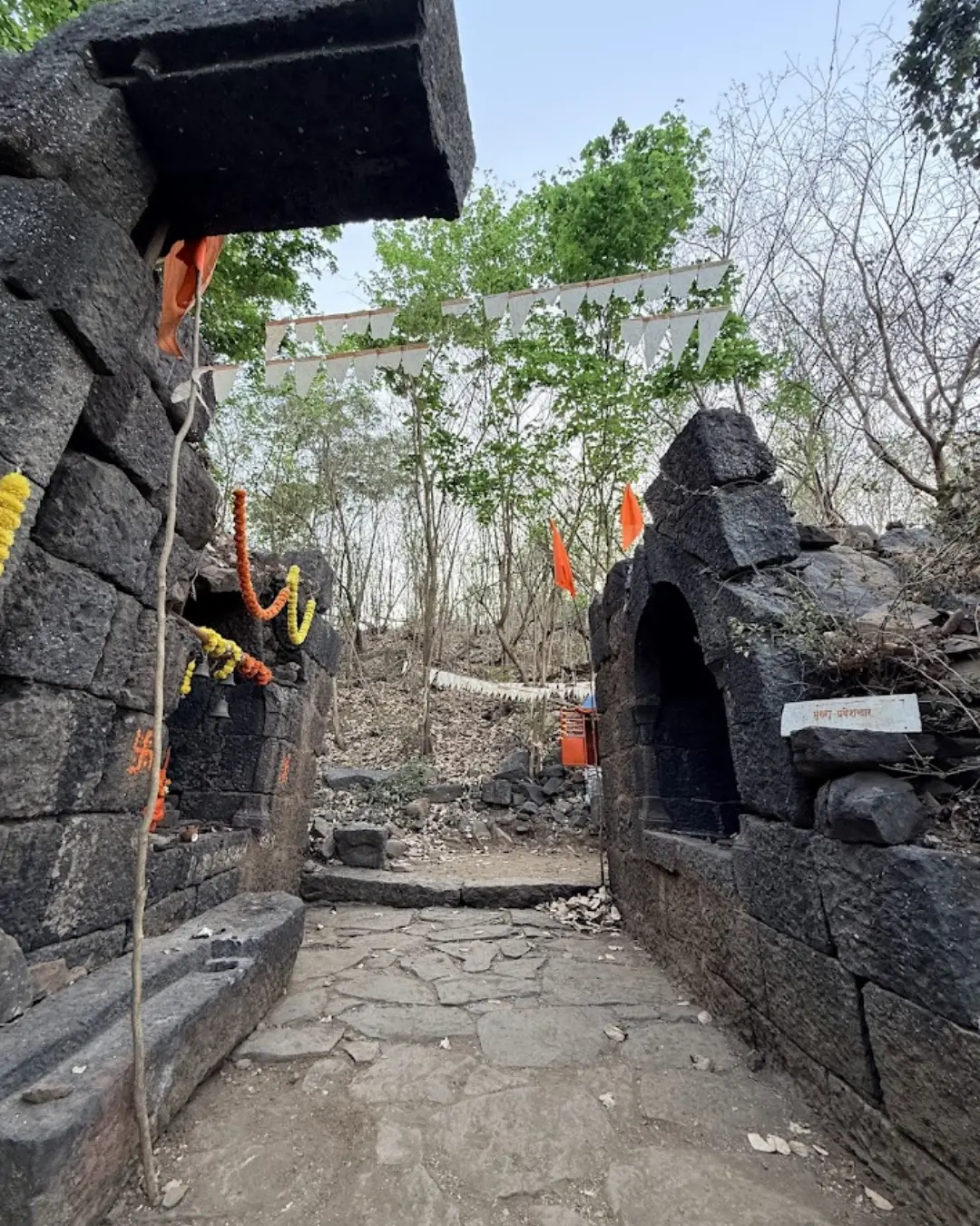
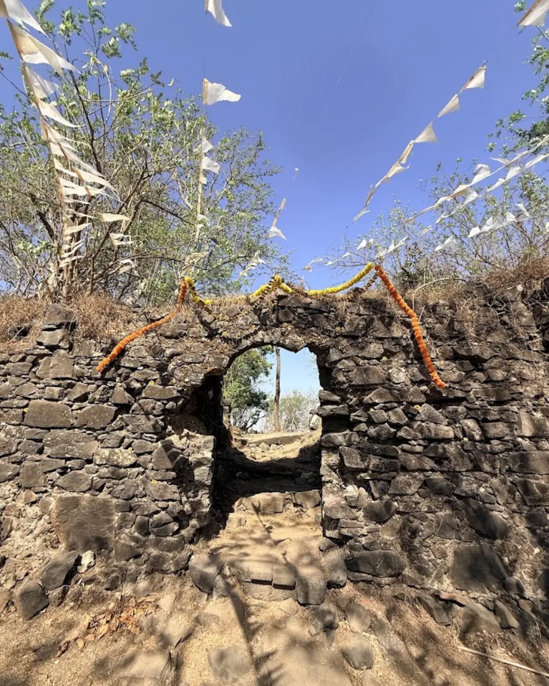
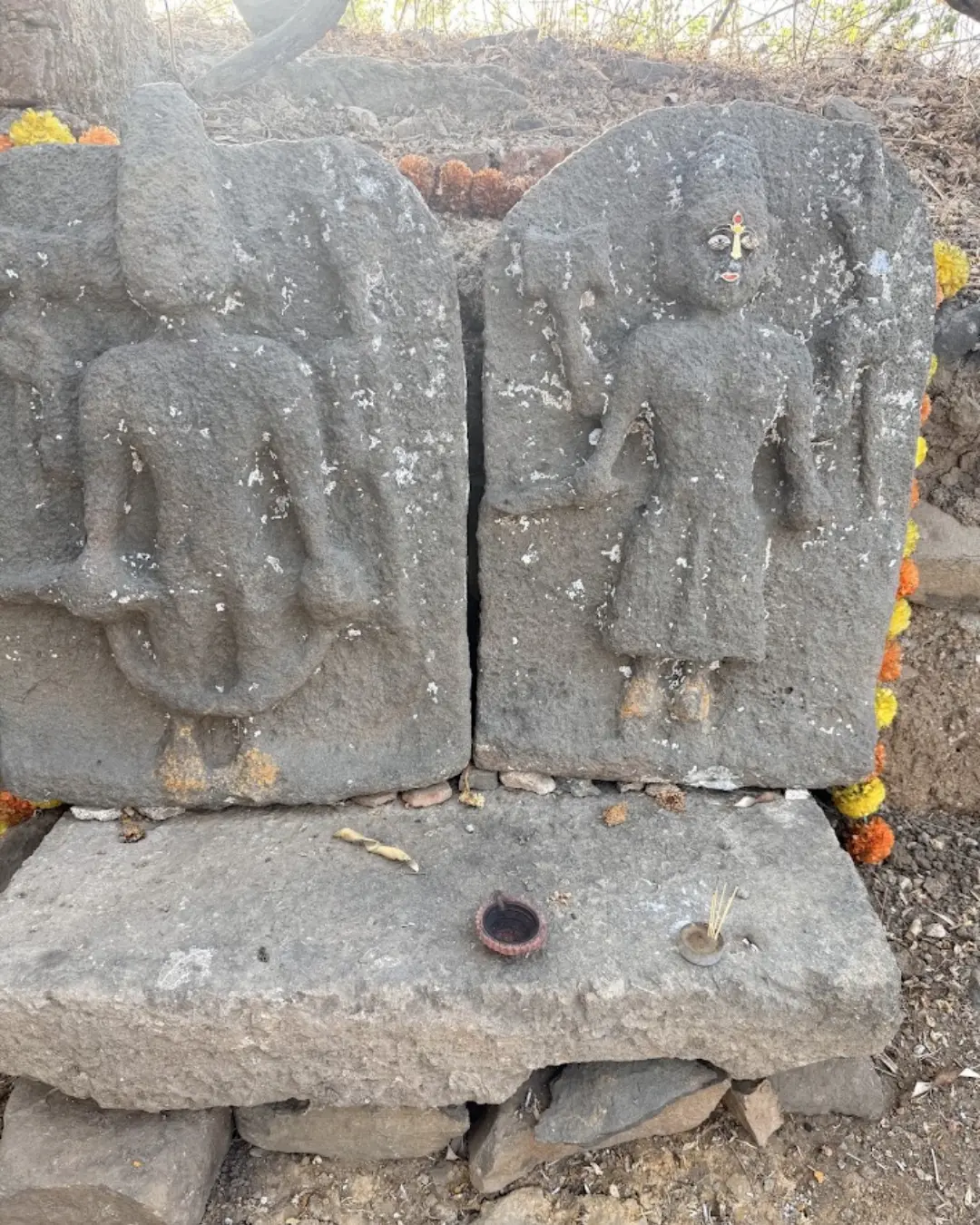
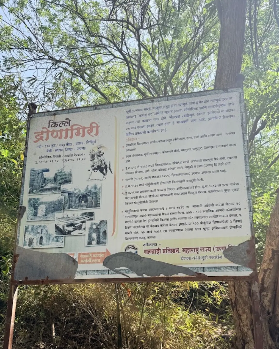

Located in the Uran taluka of Raigad district, near Navi Mumbai, Dronagiri Fort sits atop a strategic hill on Karanja Island, guarding the entrance to Mumbai harbour and Dharamtar Creek.
Surrounded by sea views, stone-carved water tanks, and 16th-century Portuguese church ruins, this fort holds immense historical importance in regional maritime warfare, including major conquests by Maratha naval forces. It is an ideal destination for a quick, rewarding one-day trek near Mumbai.
In-Depth History of Dronagiri Fort
1. Mythological Legend
According to local beliefs, during the epic battle in the Ramayana, Lord Hanuman was carrying the Sanjeevani-laden Dronagiri mountain from the Himalayas to Lanka to heal Lakshmana. Legend says that a broken fragment of the mountain dropped along the coastal waters of the Arabian Sea, giving this hill and the fort its name, Dronagiri.
2. Shilaharas and the Devagiri Yadavs (13th Century)
In early history, this maritime region fell under the northern Shilaharas and subsequently the Devagiri Yadavs. Because the hill provided clear vantage points across trade waters leading toward Gharapuri (Elephanta Island), Thane, Mahim, and Chaul, watchposts and primary fortifications were first established here during the medieval era. Following the decline of the Yadavs, regional control shifted among coastal chieftains and the Gujarat Sultanate.
3. Portuguese Rule & Construction (16th Century)
By the 1530s, the Portuguese expanded their authority across the northern Konkan coastline, including Vasai, Salsette, Uran, and Chaul. Recognizing its commanding position over maritime passages, the Portuguese reinforced the Dronagiri hill with stone bastions, outer parapets, and guard posts.
Father António do Porto: Around 1535, the prominent Franciscan friar Father António do Porto founded three religious buildings and chapels across the hill.
Nossa Senhora da Penha: Built within the citadel, this church served the Portuguese garrison. Surviving stone arches, towering walls, and lintels from this structure still stand on the summit.
4. Manaji Angre’s Conquest (March 10, 1739)
While the region saw occasional incursions by the Adilshahi and the Siddis of Janjira, the Portuguese retained a strong military presence on Dronagiri.
In 1739, during the famous Vasai campaign led by Chimaji Appa, Manaji Angre (son of legendary Maratha naval admiral Kanhoji Angre) directed offensive operations across the southern Konkan coastal belt.
On March 10, 1739, Manaji Angre led a synchronized assault that successfully captured both the fortified settlement of Uran and Dronagiri Fort from the Portuguese, absorbing the strategic post into the Maratha Empire.
This capture secured Maratha control over Karanja Island and the southern approaches to Mumbai harbour.
5. British East India Company & Decline
During the First Anglo-Maratha War in 1774, British forces occupied Dronagiri to bolster their coastal defense network around Bombay. Following the third war and the fall of the Peshwas in 1818, the fort was demilitarized, artillery pieces were removed, and the site gradually slipped into quiet ruins.
Quick Trek Overview
Location: Uran, Raigad District (Next to Navi Mumbai)
Elevation: Approx. 110-111 meters above sea level
Trek Difficulty: Easy (Beginner-friendly)
Trek Duration: 45 to 60 minutes
Base Point: Daur Nagar / Dronagiri Nagar (near Uran ST Bus Stand)
Best Season: July to February (lush monsoon foliage and cool winter air)
Key Attractions on the Fort
Portuguese Church Ruins (Nossa Senhora da Penha): High basalt stone arches and structural remnants of the 16th-century chapel.
Main Bastion & Gateway: The southern entrance preserves stone sentry alcoves (devadya), within which a carved stone idol of Lord Ganesha is safely placed.
Rock-Cut Water Cisterns (Gagaoni & Gijoni): Traditional rainwater-harvesting tanks excavated directly into the bedrock near the church.
Vetal Shrine: A rustic, vermillion-daubed forest shrine tended by local villagers tucked inside the tree cover.
Harbour & Coastal Vistas: A wide panoramic perspective showing incoming cargo ships, the Jawaharlal Nehru Port (JNPT), Uran town, and the Arabian Sea.
How to Reach
By Local Train:
Take a suburban train on the Harbour line (Nerul/Belapur to Uran line) directly to Uran Railway Station.
From the station, take an auto-rickshaw to Daur Nagar (opposite Uran ST Bus Stand) in about 5 to 10 minutes.
By ST Bus:
Direct State Transport buses run frequently to Uran ST Depot from Dadar, Thane, Belapur, and Panvel. The trekking route starts within walking distance of the depot.
By Road:
From Mumbai via Atal Setu (MTHL): Cross the Mumbai Trans Harbour Link from Sewri to Chirle Junction, then continue along the JNPT road directly into Uran (40-50 minutes).
From Navi Mumbai / Thane: Follow Palm Beach Road ➔ Belapur ➔ JNPT Highway to Uran (approx. 25-35 km).
From Pune: Mumbai-Pune Expressway ➔ Palaspe Phata ➔ Panvel-Uran Highway to Uran town.
Step-by-Step Trek Route
Walk from the Uran bus depot area toward Daur Nagar. At the edge of the residential cluster, look for an electrical transformer near the base of the hill.
The dirt trail starts immediately to the left of the transformer.
Climb through the light forest track for roughly 10 minutes until you encounter a boundary fence line; cross this and track along the right-hand ridge.
The path curves northwards through breached stone ramparts, delivering you directly into the church ruins and the citadel within 45 to 60 minutes.
Food, Water & Accommodation
Accommodation: There are no stay or camping facilities on the fort. Overnight stays are strictly prohibited due to security protocols in the surrounding coastal industrial zone.
Food & Water: No stalls or potable water sources exist on the summit. Carry at least 1.5 to 2 liters of drinking water and light refreshments. Uran town at the base has numerous restaurants, cafes, and snack centres.
Important Guidelines for Trekkers
Security Sensitivity: The fort overlooks vital industrial installations (ONGC, naval zones, and port infrastructure). Observe all local warning signs and refrain from photographing restricted facilities.
Trek Timing: Coastal humidity can be exhausting during midday. Begin your hike early between 7:00 AM and 9:00 AM or in the late afternoon after 4:00 PM.
Preserve the Site: Do not litter or deface the historical stonework, and ensure all plastic waste is packed out with you.