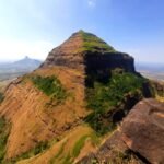
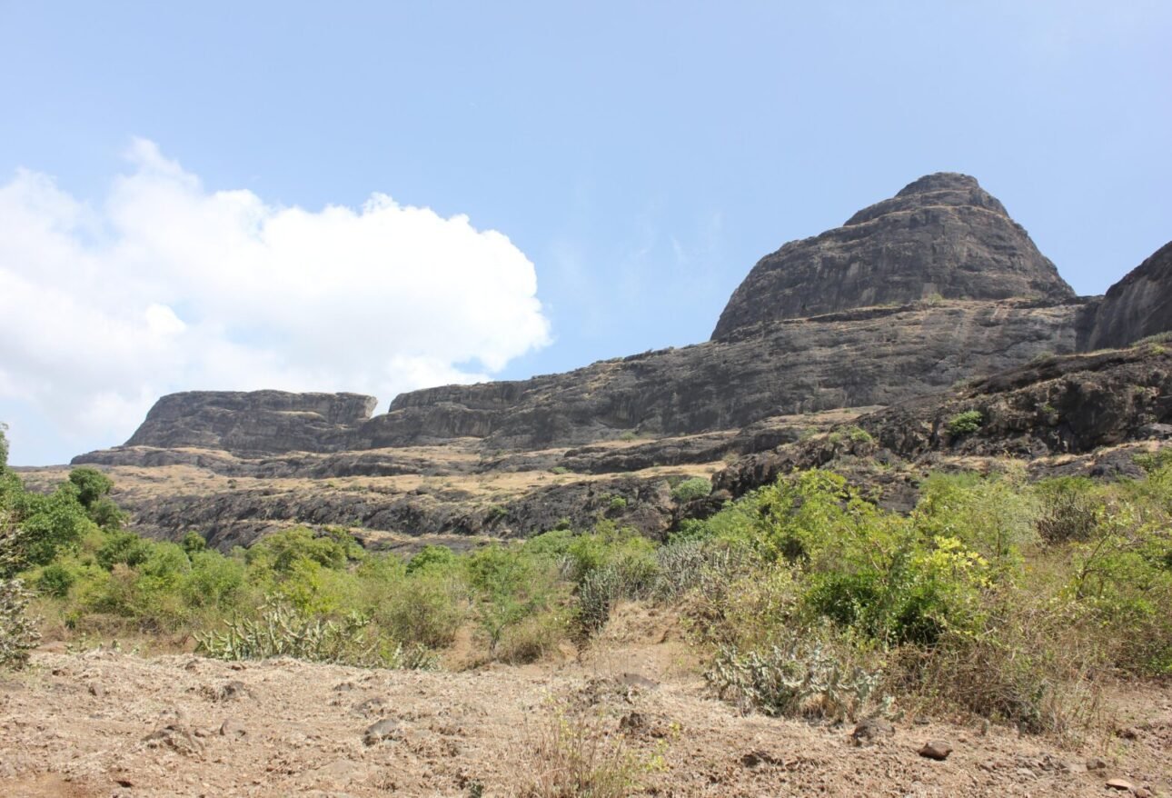
Dhodap is one of the great forts of the Sahyadris. It is the second highest fort in Maharashtra after Salher, and its pointed cliffs, rock-cut steps and wide tunnel make it unforgettable. This guide covers the Dhodap Fort trek route, the history, what you will see on top, how to reach it from Nashik, Mumbai and Pune, and the best time to go.
Dhodap Fort at a Glance
- Location: Chandwad taluka, Nashik district, Maharashtra
- Range: Satmala range of the Sahyadris
- Height: about 1,470 m (roughly 4,800 ft). It is the second highest fort in the Sahyadris after Salher
- Base village: Hatti (also known as Dhodambe), about 55 to 60 km from Nashik
- Difficulty: Medium, with steep rock-cut steps near the top. Some trekkers find it harder than the grade suggests
- Best season: Monsoon end to winter (September to February)
History of Dhodap Fort
Dhodap stands on a strategic height above a major trade route. According to historical accounts, Chhatrapati Shivaji Maharaj visited the fort in 1670 while returning from his second raid on Surat. In 1768, Madhavrao Peshwa defeated the forces of his uncle Raghunathrao near Dhodap, and Raghunathrao later took shelter at the fort. The top of the fort is built from dressed stone and brickwork, and strong bastions guard its sides.
Things to See on Dhodap Fort
- Rock-cut steps: the way to the top is a long series of steps carved into the rock, which is the signature of this trek.
- The wide tunnel: a passage cut through the rock, about 5 metres wide, that you walk through on the way up.
- Shembi and the Ikhara cliff: a sharp pointed cliff called Shembi, and the steep Ikhara cliff on the eastern side, which is also a rock-climbing spot. The Ikhara pinnacle stays in view through much of the trek.
- Caves and temples: several large caves at the base, a cave temple in good condition, and shrines of Hanuman, Shiva and Ganesha.
- Water tank with a Hanuman idol: a tank on the fort with drinking water. Even so, carry your own water.
- Views: to the west you can see Saptashrungi, Markandeya, Rawlya and Jawlya. To the east you can see the twin forts of Kanchan and Manchan and Kanhergad.
Dhodap Fort Trek Routes
- From Hatti (Dhodambe): the most popular route. Nashik to Wadali Bhoi is about 50 km, and from there Dhodambe is about 8 km further.
- From the Deola side (Hanmantpada): described as a simpler approach with an easier access road, about 15 km from Deola.
The top is reached through the rock-cut steps and the tunnel, so the climb is steady rather than technical, but it is long and exposed. A local guide from the base village is useful on your first visit.
How to Reach Dhodap Fort
- From Nashik: about 55 to 60 km by road. Take the Nashik, Wadali Bhoi, Dhodambe route. Another route runs towards Malegaon on the highway.
- From Mumbai and Pune: reach Nashik by train or road first, then continue by road to Hatti or Dhodambe. Most trekkers take a night journey and start the climb early in the morning, or stay in Nashik the night before.
- Stay: villagers at the base can usually help with a simple stay and a meal.
Best Time to Visit Dhodap Fort
The best time is from the end of the monsoon until about February. The hills are green after the rains, the views are long and the weather is pleasant. In heavy monsoon the steps can be slippery and the top is often in cloud. Summer is hot and tiring on this open fort.
Things to Carry
- 3 litres of water or more, plus snacks, as the climb is long
- Trekking shoes with strong grip, a cap and sunscreen
- A light jacket, as the wind on top can be strong
- A torch, a power bank and a basic first-aid kit
- An ID card and some cash for the base village
Tips for a Safe Trek
- Start early and plan to be back before dark
- Keep away from the edges of the pointed cliffs, especially in wind and fog
- Use the rock-cut steps one person at a time when they are wet
- Carry your plastic and waste back down
More Treks Near Nashik
Dhodap sits in the same Satmala range as Koldher Fort and Rajdher. If you love high forts, also look at Salher, the highest fort in the Sahyadris. We run group treks to forts like Ratangad and Harishchandragad. See all upcoming treks, or message us on WhatsApp if you would like to ask about a group trek to Dhodap.
Dhodap Fort Trek: Frequently Asked Questions
Where is Dhodap Fort?
Dhodap Fort is in Chandwad taluka of Nashik district, in the Satmala range. The base village is Hatti, also called Dhodambe.
How high is Dhodap Fort?
About 1,470 m (roughly 4,800 ft). It is the second highest fort in the Sahyadris after Salher.
How difficult is the Dhodap Fort trek?
It is graded medium. The climb is long, with steep rock-cut steps and a wide tunnel near the top, and it feels harder in heat or rain.
How far is Dhodap Fort from Nashik?
About 55 to 60 km by road, via Wadali Bhoi to Dhodambe.
Is there water on Dhodap Fort?
There is a water tank on the fort, but carry your own water to be safe.
What is the best time to visit Dhodap Fort?
From the end of the monsoon to February. Avoid peak summer and heavy rain.
Cover photo: View of Dhodap from Hatti by Bhushan Kotakar, CC BY-SA 3.0, via Wikimedia Commons.